-
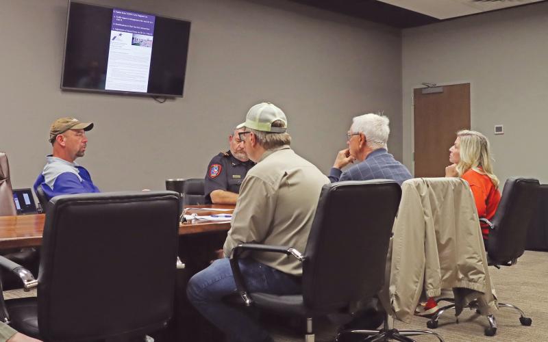 (THOMAS WALLNER | THE GRAHAM LEADER) Texas Department of Transportation Graham Area Engineer Zach Husen speaks with the Transportation Improvements Committee for the city of Graham during their meeting Thursday, April 3.
 -
 (ZACH HUSEN | CONTRIBUTED PHOTOS) Two maps showing wrecks at in Graham from Dec. 30, 2019 to Dec. 30, 2024. The left map is a heatmap of all crashes in the city while the right map shows crashes at intersections in the city. The Transportation Improvements Committee for the city of Graham analyzes data like this to make determinations on what needs to address.
 -
 (ZACH HUSEN | CONTRIBUTED PHOTOS) Heat maps of the city of Graham of crashes that are related to an intersection, distracted driving or speed from Dec. 30, 2019 to Dec. 30, 2024.
 -
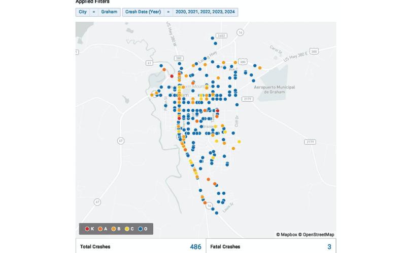 (ZACH HUSEN | CONTRIBUTED PHOTO) All crashes in the city of Graham from Dec. 30, 2019 to Dec. 30, 2024 that are shown in color under one of five possible classifications from the Texas Department of Transporation.
The Graham Transportation Improvements Committee analyzed five years of crash data from within the city of Graham to better service the area's needs.
TxDOT Graham Area Engineer Zach Husen spoke to the city committee Thursday, April 3 regarding five years of data from the state organization.
“You'll see very clearly that our top three contributing factors to crashes are intersection related crashes, distracted driving related and speed related. ...That's what is listed as either the factor, or the contributing factor to the crash,” Husen said.
A total of 486 vehicle wrecks occurred from Dec. 30, 2019 to Dec. 30, 2024 within the city of Graham, with three of those being fatal wrecks. Of those total wrecks, 256 were related to an intersection, 226 were related to distracted driving and 112 were related to speed.
The top six intersections where crashes occurred in the city were Hwy. 16 at Fourth Street, U.S. 380 at FM 3491, U.S. 281 at Hwy. 25/FM 174, Hwy. 16 at Montgomery Road, Hwy. 79 at FM 1954 and Hwy. 183 at U.S. 82/FM 422.
A total of 16 wrecks occurred in the last five years at Hwy. 16 at Fourth Street, 10 at U.S. 380 at FM 3491, nine at U.S. 281 at Hwy. 25/FM 174 and eight at Hwy. 16 at Montgomery Road, Hwy. 79 at FM 1954 and Hwy. 183 at U.S. 82/FM 422.
The five-year crash data presented splits the wrecks into fatal (K), incapacitating (A), non-incapacitating (B), not visible but complaints of pain (C), uninjured (O) and unknown injury (U).
The intersection with the highest A and B crashes is Hwy. 183 at U.S. 82/FM 422 with a total of one A crash and two B crashes. The intersection of Hwy. 16 and Hwy. 67 had a total of three B crashes within the last five years.
“The top two there are going to be (Hwy.) 16 at (Hwy.) 67, our busiest intersection in town, and then (Hwy.) 16 at 1287,” Husen said. “The reason that you have more severe crashes there is because the traffic's going faster.”
One of the initiatives of the transportation committee is to find a safety solution to the Hwy. 16 and Montgomery Road intersection ranked fourth in number of crashes with eight total.
TxDOT contracted the work on the intersection to the engineering firm Garver who were tasked with analyzing a section of Hwy. 16 from a traffic safety perspective and to make a recommendation to the committee.
“They have returned their recommendation to us and we’re in the review stage of that report,” Husen said. “After they receive our comments, they’re supposed to issue us a final report next month.”
The engineering firm determined the Hwy. 16 and Montgomery Road intersection met the warrants for a traffic signal.
A reduction of the posted speed limits to 35 mph for Hwy. 16 at Cherry Street and Montgomery Road and 40 mph at Pine Tree Road and Walmart Drive were also recommended.
A heat map of crashes throughout the city was presented to the board along with a crash grid that showed a pattern of wrecks at intersections down many streets.
“You can see Calaveras Street, you can see First Street, you can see Third (Street) and Fourth (Street) as being intersections in a row of having multiple crashes,” Husen said. “...What all those intersections have in common are they are all two-way stop control intersections.”
The committee will continue to evaluate the data to determine how to move forward on transportation projects.